The invention of GPS can be traced from the Cold War when the Sputnik I satellite was launched by the Soviet Union.
In the 1960s, the groundwork for the modern-day GPS system was completed by The Aerospace Corporation.
What began as a way of studying the Earth from space quickly evolved into a universal technology utilised by nearly every country in the world.
Not just countries, but even Dora from the American children's animated series Dora and Friends (previously Dora The explorer) now relies on her phone map to guide her!

How the world has changed!
In this article, we will discuss what is a GPS, how it works, and why you should equip the Gyrochute with a GPS.
Let's check it out!
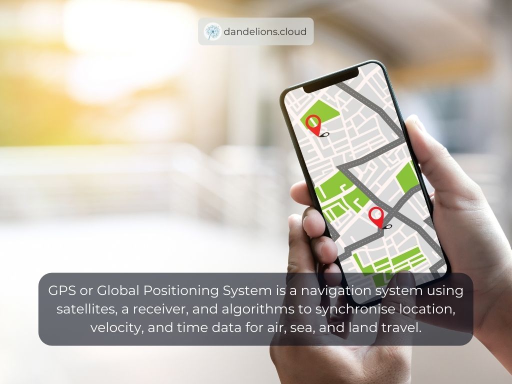
What Is GPS?
GPS or Global Positioning System is a navigation system using satellites, a receiver, and algorithms to synchronise location, velocity, and time data for air, sea, and land travel.
The GPS consists of 3 different components that work together to give out location information.
The three components are:
Space (Satellites) — Satellites that circle the Earth transmit signals to users on geographical position and time of day.
Ground control — The Control Segment includes Earth-based monitor stations, master control stations, and ground aerial. Control activities include tracking and operating the satellites in space and monitoring transmissions.
User equipment — They are items such as smartphones, watches, and telematic devices that act as GPS receivers and transmitters.
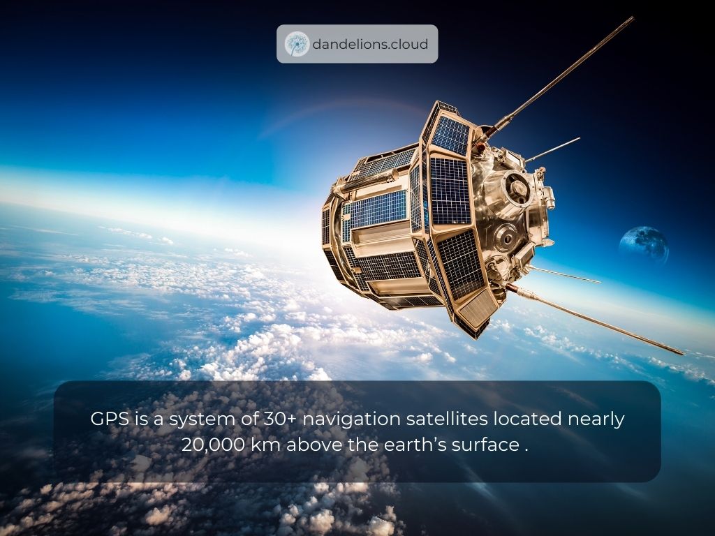
How Does GPS Work?
GPS is a system of 30+ navigation satellites located nearly 20,000 km above the earth’s surface. Every satellite transmits different signals which can be tracked via a GPS receiver on earth. A GPS receiver in your phone (or other devices like your smartwatch) listens for these signals.
Once the receiver calculates its distance from four or more GPS satellites, it can figure out where you are. The signals operate in all weather conditions but can’t penetrate through solid objects, so GPS receivers function best when they have a clear view of the sky.
Why Equip The Gyrochute With A GPS?
If this is your first time here, you're probably wondering, what is a gyrochute?
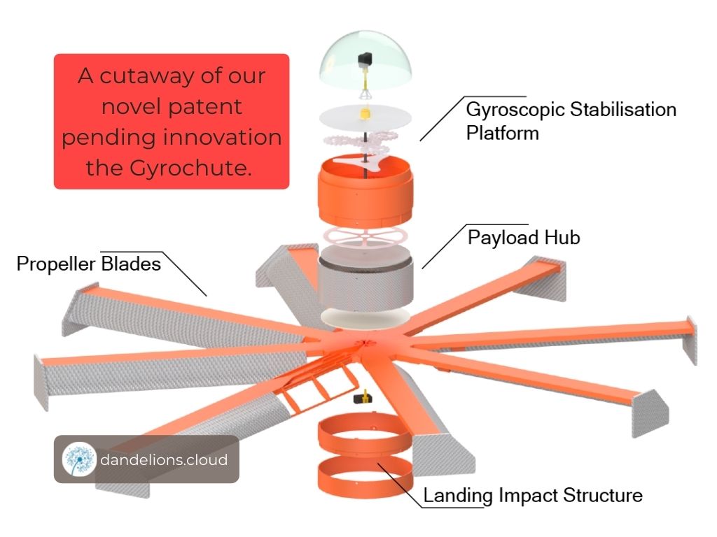
The Gyrochute is an unpowered safe descent vehicle that we at Dandelions is currently developing. The vehicle relies on the principle of auto-rotation, not only air resistance, to securely deliver payloads.
Our Gyrochute comes with a payload container that you can fit with GPS.
So, why equip the Gyrochute with a GPS?
1 - Determining A Lost Person's Position
Gyrochutes equipped with GPS can help determine a lost person's position by utilising our swarm capabilities.
Let's give an illustration. Pre-deployment, the Gyrochute will be fitted with a GPS. This way, we can determine the target landing position of the Gyrochute. The Gyrochute will also contain a communication package, for example, a WiFi network.
The first Gyrochute will be dropped in area A. We will pop up a message on the lost person’s phone even if they are not connected to the wifi, sending them a hint that there is a network available.
Let's say that this person's phone GPS does not work, and s/he does not know where they are, then we will have to drop extra Gyrochutes.
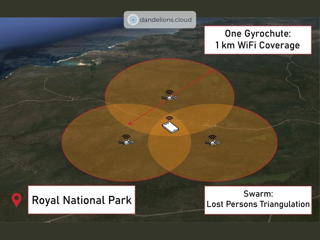
The second Gyrochute will be dropped in area B. This will help narrow down the location of the lost person.
The third Gyrochute will be dropped in area C. By using triangulation, we will be able to determine the exact position of the lost person.
Triangulation works by comparing signals from three different receiving points, and where they intersect is the position of our target.
Since each Gyrochute is fitted with GPS, it will be quick to find that intersection.
2 - Sending Navigational Kit
With precise position landing, the Gyrochute can land in areas that are hard to access.
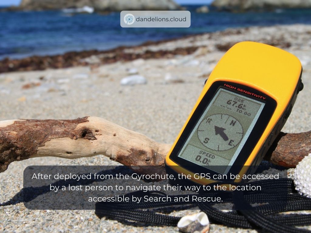
For example, a person is lost during a hike. A helicopter managed to find the person, but there is no space for the helicopter to land. Therefore, the Gyrochute is deployed equipped with GPS devices, radio communication, and other survival kits.
The lost person can now navigate their way to the location accessible by Search and Rescue.
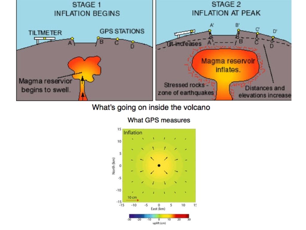
3 - Track Ground Movements at Volcanoes
The Gyrochute equipped with GPS devices will be deployed around a volcano.
By studying data from the sensors over a period of time, experts can determine whether the ground surface has shifted. With the combination of data collected from a GPS network, it is possible to get a broader view of which areas of the volcano's surface are moving as well as the speed and direction of movement.
Conclusion
In this article, we have talked about what is GPS, how a GPS works, and why you want to equip the Gyrochute with GPS.
The Gyrochute can be equipped with various other payloads, such as rain or temperature sensors, and also 360-cameras.
Contact us at hello@dandelions.cloud for more information about our products or about how our products can fit your use cases!